SOIL MOISTURE ILLUMINATES THE BIGGER PICTURE
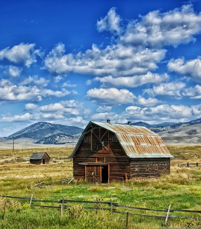
Heavy rains came mid-September of 2017, which led some people to believe the drought was over. However, changes in soil moisture told a different story. Very little of the rain made it into the soil. “At the Havre, MT station you can see we had some heavy precipitation events. Then we had early October snows. So people expected good soil water recharge. But at the end of the day, we didn’t get it. On Sept.15th, soil moisture sensors showed a big soil moisture response at the surface but only a marginal response at 8 inches.” The melt of early October snows onto the soil, still damp from the September rain, drained to 20 inches or more. But as the snowmelt dissipated, there was minimal net gain going into the winter.
PREDICTIVE MODELS NEED MORE COVERAGE TO BE EFFECTIVE
Typically in the U.S., the National Weather Service (a division of NOAA) puts out a network of weather monitoring stations spaced out across the country, and that data gets fed into forward-looking models that help predict the weather. Dr. Doug Cobos, research scientist at METER says, “What people are finding out is that putting in a sparse network of very expensive systems has done really well. It’s been a good thing. But the spatial gaps in those networks are a problem, especially for agriculture producers and ranchers. They need to know what’s happening where they are.”
MESONETS IMPROVE SPATIAL DISTRIBUTION
Mesonets present a practical solution for the need to fill in data gaps between large, complex weather stations. The Montana Mesonet currently has 57 stations interspersed throughout the state, and through partnerships with both the public and private sector, they’re adding more stations every year. At each location, the Montana Mesonet team installs METER all-in-one weatherstations, soil moisture sensors, NDVI sensors and data loggers that integrate with ZENTRA Cloud: an easy-to-use web software that seamlessly integrates into third-party applications through an API. Hyde says the system enables better spatial distribution and reliability.