Video: ATMOS 41 cleaning instructions
Our application experts demonstrate how to correctly clean the ATMOS 41 all-in-one weather station.
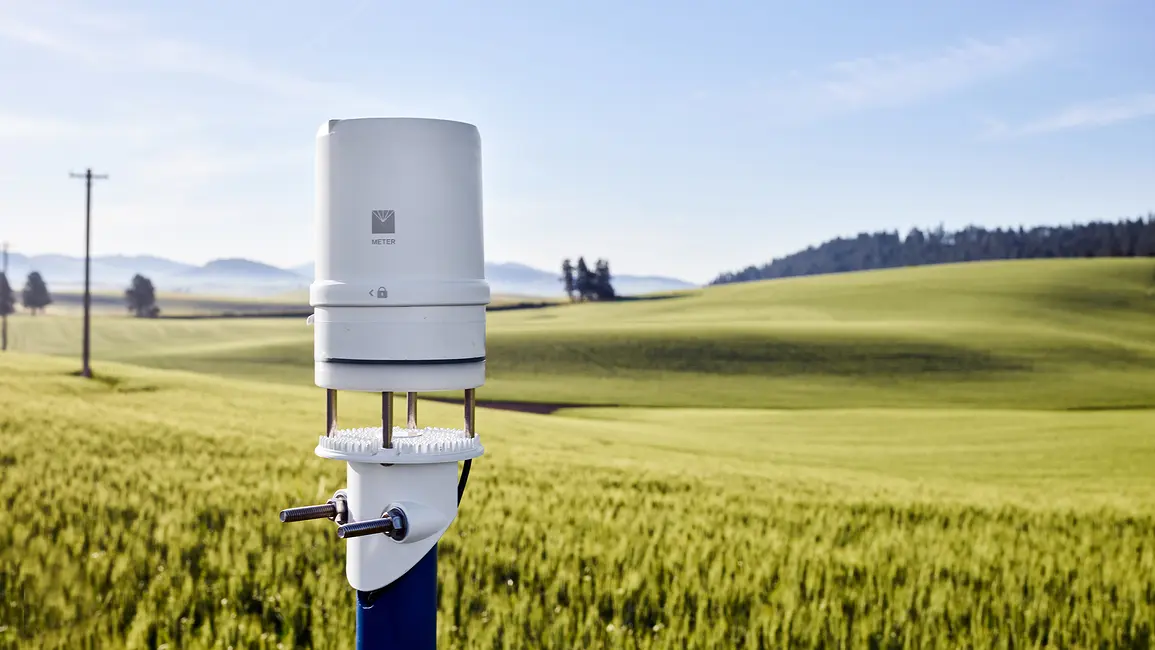
At METER, we’ve installed thousands of remote weather stations and weather instruments over the years, so we’ve learned a lot about what to do and not to do during an installation.
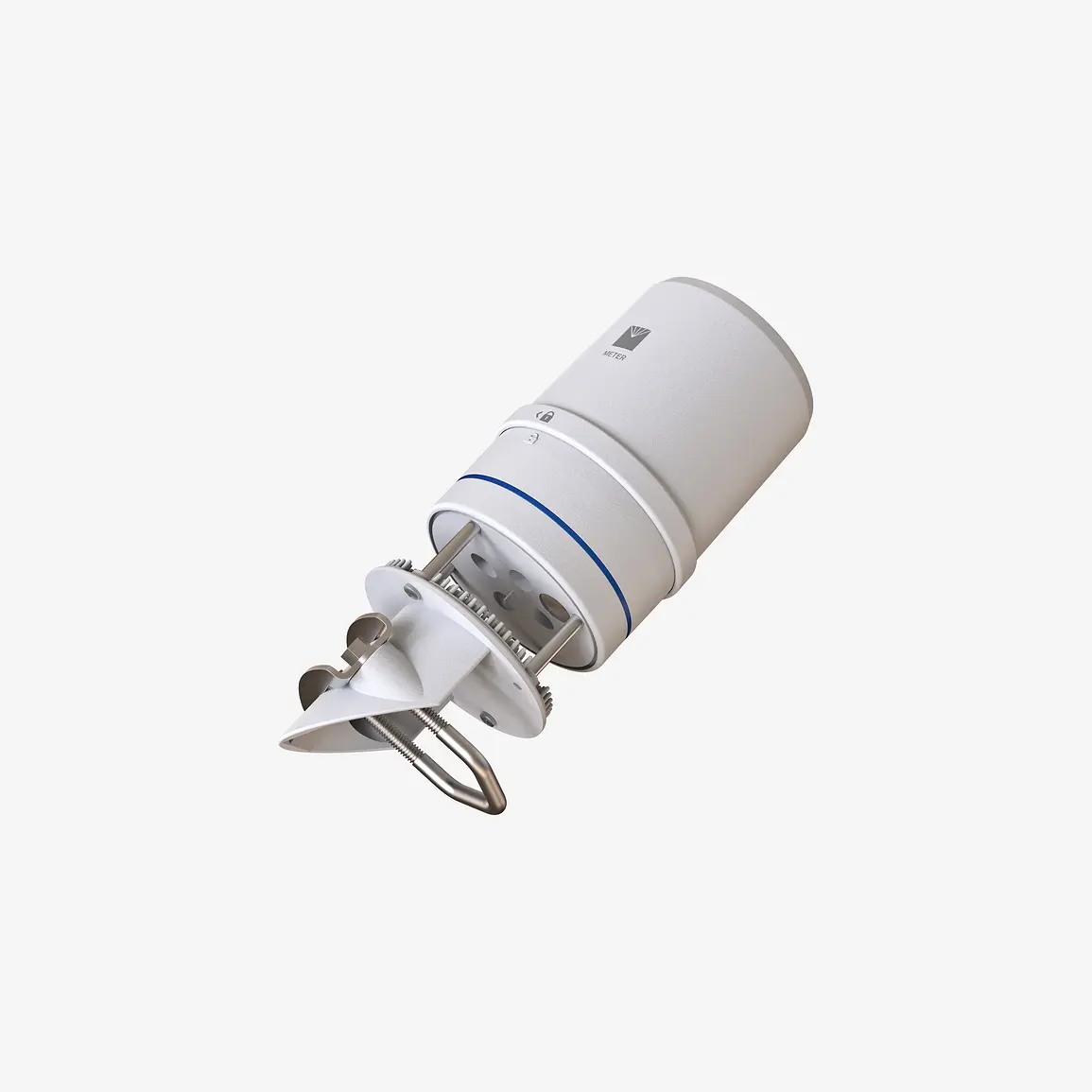
This article takes an in-depth look at seven basic steps you’ll want to think about as you set up your weather station in order to obtain the highest quality weather data.
One important thing to remember is that to obtain high quality data, you’ll need to install the right weather station for your unique application. In this 20-minute webinar, research scientist, Dr. Doug Cobos explores which types of weather stations fit different types of applications. Find out:
One often overlooked step to a good installation is testing your weather instruments before taking them to the field. It’s important to set your instrumentation up before you leave so you know everything is functioning and you have all the tools you’ll need. You can test your equipment at the office, in your yard, or even at a nearby park. Get all your mounting hardware together, and make sure all the weather instruments and sensors are functioning. If you have a battery-powered system and a solar panel, check to see if they are charging. Ensure your data acquisition system is working. If using a programmable data logger like a Campbell Scientific logger, make sure you understand how to program it. Test the logger program to ensure it is functioning correctly and recording. Many data acquisition backbones now have remote data delivery, so check that data are flowing into the server and you’re able to access those data.
Figure 2 is an example of a testing site where Montana Mesonet sets up every one of their stations on a rooftop to do comparison testing. This helps them check if everything is working and ensures they have all the necessary equipment for their installation. If you do this, you’ll have all the right tools, mounting hardware, and various widgets that you’ll need to get set up.
There are rules outlined in the various weather observation standards that list best practices for siting your weather instruments. One standard best practice is to choose a site with minimal slope. This may not be possible in all areas, but choose a site with the least slope possible. You should also site your weather station far from obstructions: the World Meteorological Organization (WMO) calls for a minimum distance of 10 times the height of the obstruction. For example, if you have a two-meter shrub at your site, your weather instruments should be located 20 meters away from that shrub. ASABE standard calls for 10 to 50 times the height of the obstruction.
Another best practice is to site your weather instruments with a homogenous fetch (no changes in land use and no obstructions) of 100 times the height of your weather station. So if you have a weather station at a two-meter height, it’s optimal to have a homogenous fetch of approximately 200 meters. Figure 3 is an ideal site for obstructions and fetch, which makes it an optimal site for general weather observations.
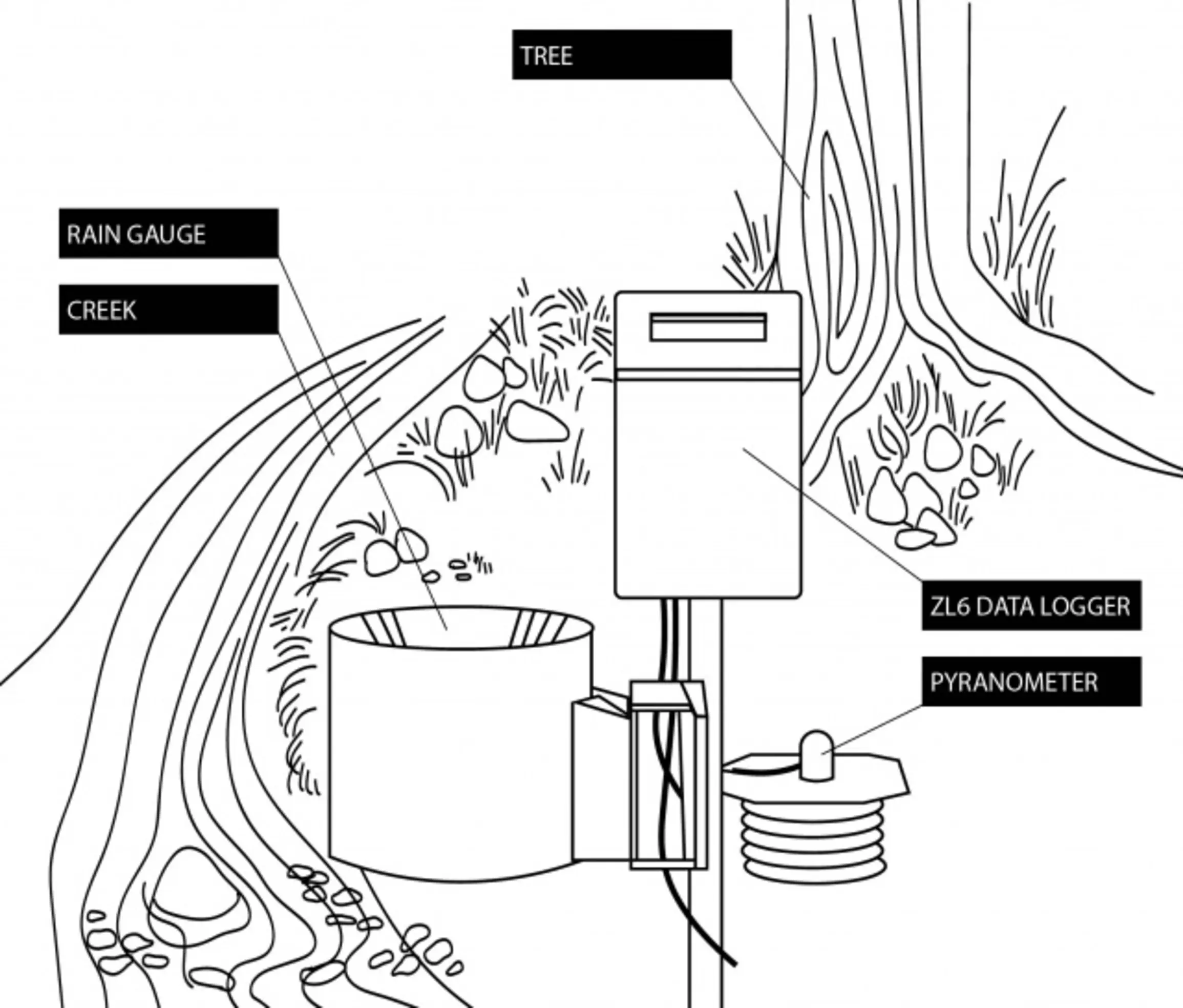
Another thing to watch out for is overhead obstructions to your pyranometer and your rain gauge. If you have an obstruction over your rain gauge, it’s going to mess up your rainfall measurement. Always check your pyranometer “view factor”. If you look at Figure 4, there is a pyranometer sitting below the data logger and under a tree canopy. Obstructions like these will confound the pyranometer data.
Additionally, if you have a pyrgeometer for long wave radiation or a net radiometer, those weather instruments typically have a hemispherical or 180-degree field of view. If there are any trees or buildings obstructing the 180-degree hemispherical field of view it could be a source of bias or error. So it’s important that those types of weather instruments are exposed to the open sky.
You also want to site your remote weather station far from any objects that will heat up in the sun and increase your air temperature unnaturally, such as buildings, pavement, trails, and even bare soil if you’re on a vegetated site. And don’t locate your weather station close to water bodies like in Figure 4.
Note that the rules discussed above are for general weather observations and not necessarily for specialty observations. Figure 5 illustrates standards from a guide for a tier 1 site from WMO.
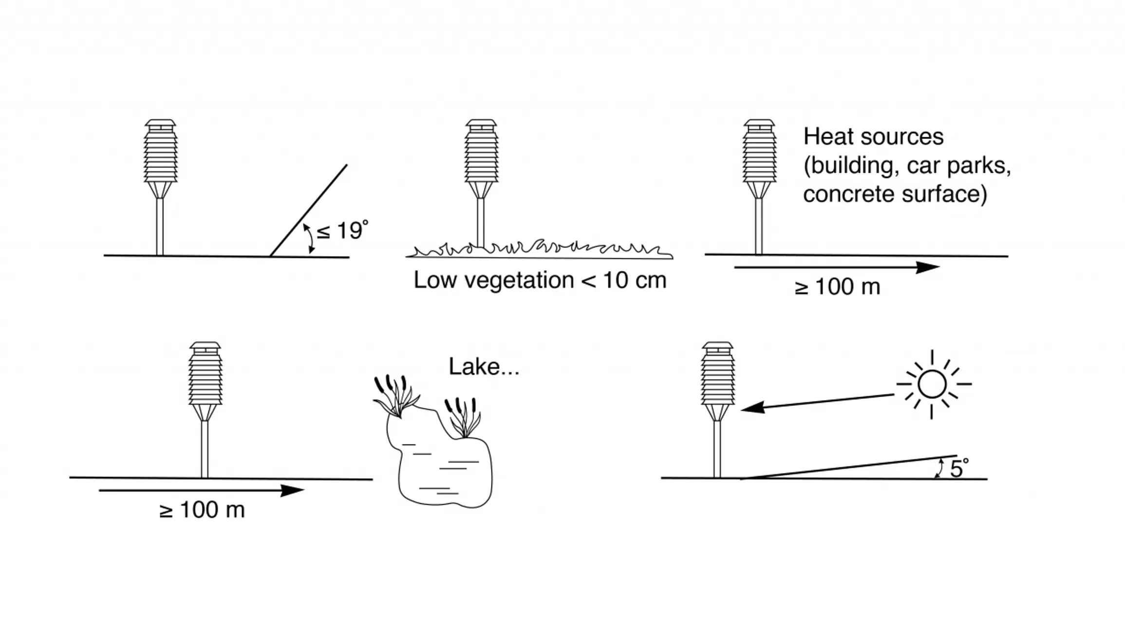
WMO guidelines recommend minimal slope, low vegetation, siting 100 meters away from heat sources, and siting 100 meters away from water bodies.
One last thing to consider when siting weather instruments and remote weather stations are the microclimate effects. Don’t site your instruments in a local depression. In a local depression, if there’s a clear night with stable conditions and then an inversion, it can cause a large bias, especially in your air temperature.
Figure 6 shows a diagram of a METER rooftop testbed where we test ATMOS 41 all-in-one weather stations. About 220 meters to the left, there is another METER testing site in a creek bed where we test soil sensors, hydrology equipment, and water depth sensors. Between the two sites there is approximately a 30 meter elevation change and about 220 meters of horizontal distance.
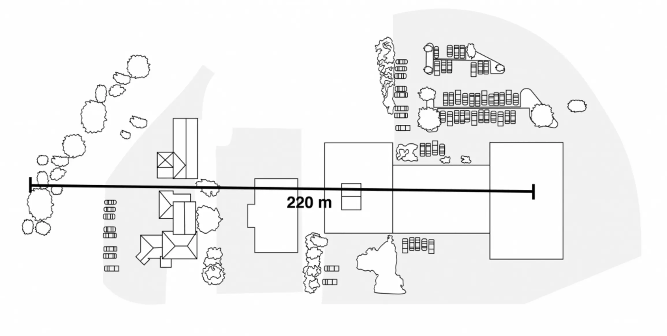
Recently, we checked the low temperature of these sites in ZENTRA Cloud and found there was a full 6 ℃ temperature difference between the rooftop testbed and the creek bottom testbed. So that gives you an idea of the magnitude of errors you could get from siting your remote weather station or weather instruments in a localized depression.
Additionally, pay attention to the vegetation near your site. The vegetation should be representative near your weather station. And it’s important to not site your weather monitoring system on a ridge top because it will give you a measurement bias. Similarly, the rooftop is generally a poor weather monitoring site. In fact, the standards organizations won’t accept a rooftop installation because you get substantial air temperature biases from the rooftop heating up. (At METER, we get away with a rooftop testbed to look for performance issues because we’re not trying to do high quality weather observations at that site. But just note that a rooftop is typically a poor location).
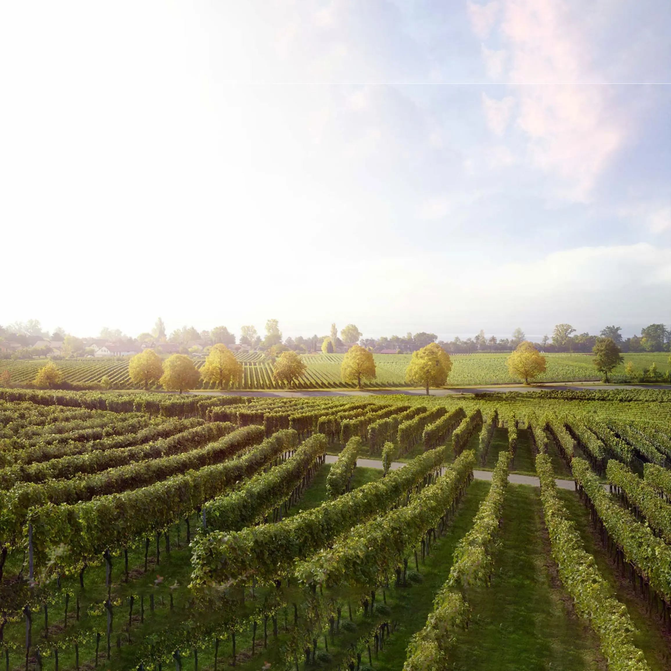
If you need to characterize a specific microclimate, then you should locate your weather station in that microclimate. For integrated pest management or any kind of disease modeling, often monitoring needs to be done in the crop canopy. If you’re looking at animal comfort, you should site your weather instruments in the enclosure where the animal is located, or the measurements won’t be representative. If you’re measuring human comfort in urban areas like a sports venue, your weather station should be located at the sports venue. If you want to measure “plant comfort” (i.e., when to water or plant stress) in a particular crop, you can’t get your weather data off the internet. You’ll need to put weather instruments in that microclimate, or your measurements won’t be representative.
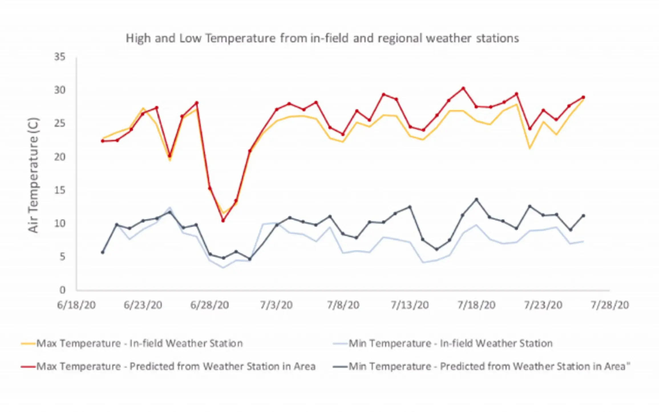
For example, in Figure 8 you can see that for a particular potato field in Idaho, infield weather station data and regional weather station data off the internet do not agree. In this video, Dr. Colin Campbell shows how this could affect the accuracy of your growing degree day (GDD) model predictions.
When you go to the field, take more tools than you think you need. Having a dedicated installation shovel and a dedicated toolbox filled with important tools such as zip ties, pliers, markers, flashlights, and batteries can save hours of trips back and forth to the site.
In addition, think about using an exclosure to keep animals and people out (Figure 9).
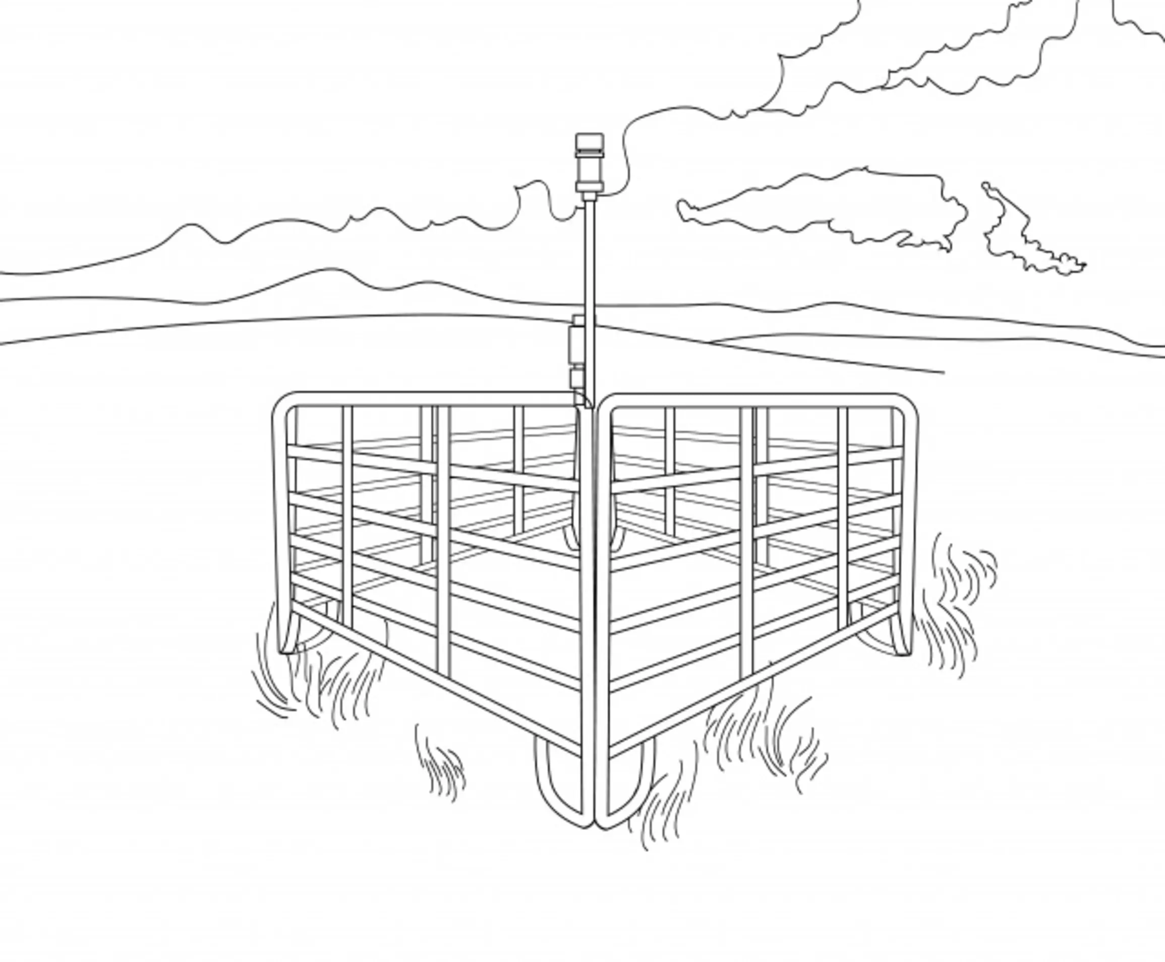
METER partners with TAHMO who is now operating the largest operational weather network in Africa with close to 600 remote weather stations. They put exclosures around all of their ATMOS 41 stations to keep animals and people out because leaving weather instruments exposed in Africa often results in things going missing. Also, animals can be destructive to instrumentation. One researcher in East Africa has problems with hyenas yanking out cords and even an elephant wandering off with his entire weather station. So think about putting a fence around your site.
It’s also important to tighten up your mounting hardware before you leave. METER has a rainfall testbed at Texas A&M University where we study the high intensity rainfall from Texas thunderstorms. Recently we pulled up the data from that testbed and saw some rainfall anomalies. When we checked the accelerometer data, we saw that all the weather stations were off level. Figure 10 is an artist’s re-creation of what our research tech saw when he went to check the weather stations. The fittings had slipped, and he had to completely rework this testbed.
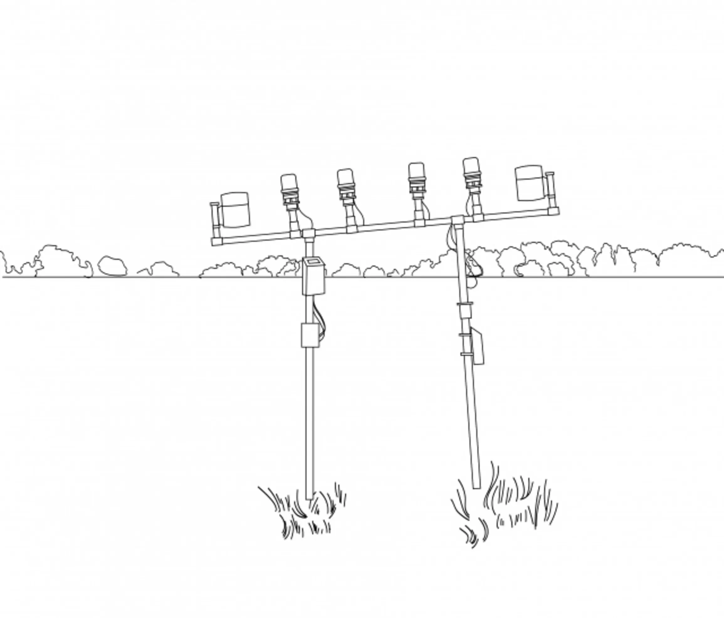
You should also install guy wires to hold everything stable in case of a severe weather event. If you don’t guy things down, you’ll end up with instrumentation oriented horizontally instead of vertically.
Remember to orient your wind direction sensor to true north or south (instead of magnetic) to account for magnetic declination. Also ensure that you shield your temperature sensors from radiation. This may be taken care of when you choose your instrumentation, but it’s something that can be overlooked. To find out why this is important, watch the following webinar where Dr. Doug Cobos looks at the energy balance of exposed radiation sensors that are exposed to radiation discussing the errors it may cause.
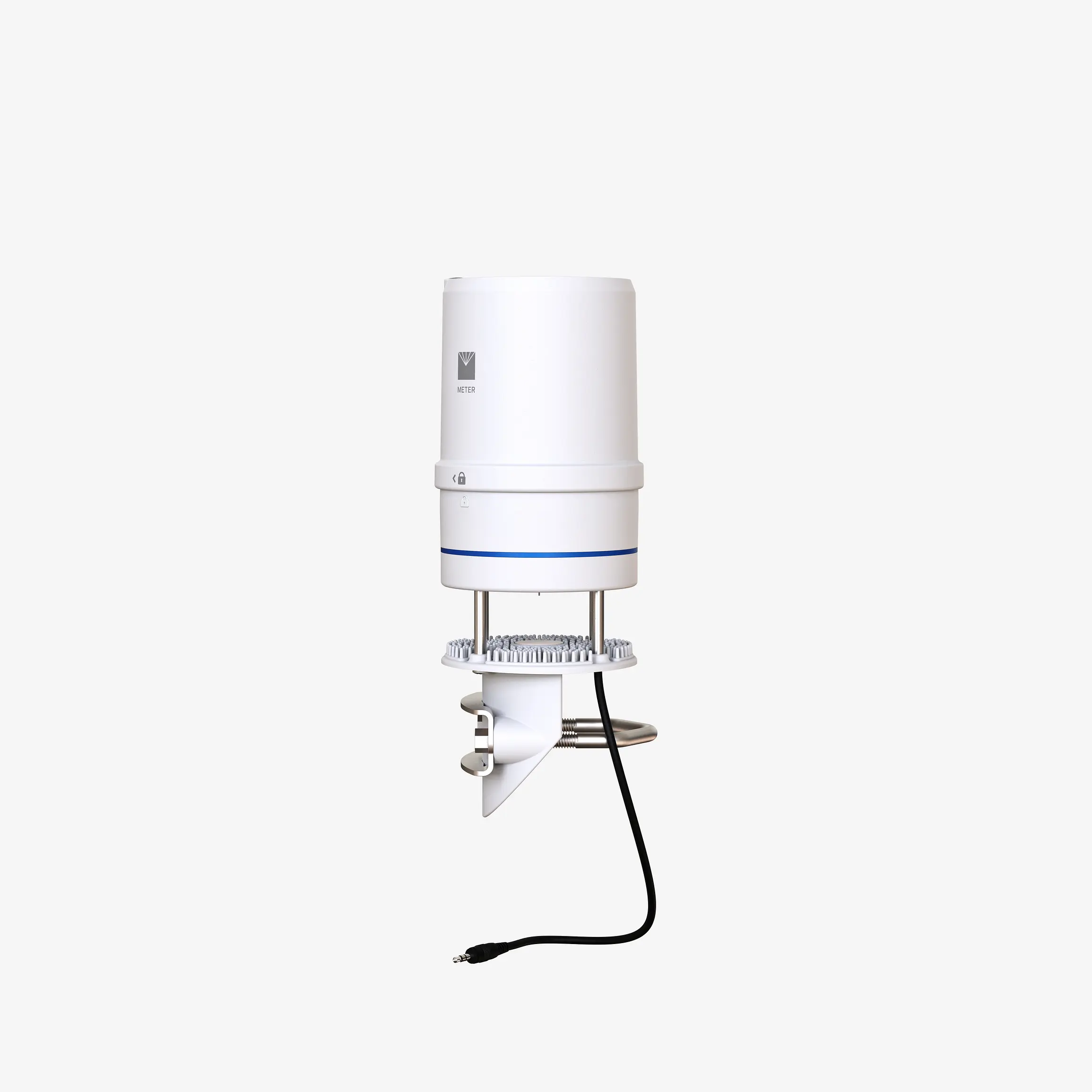
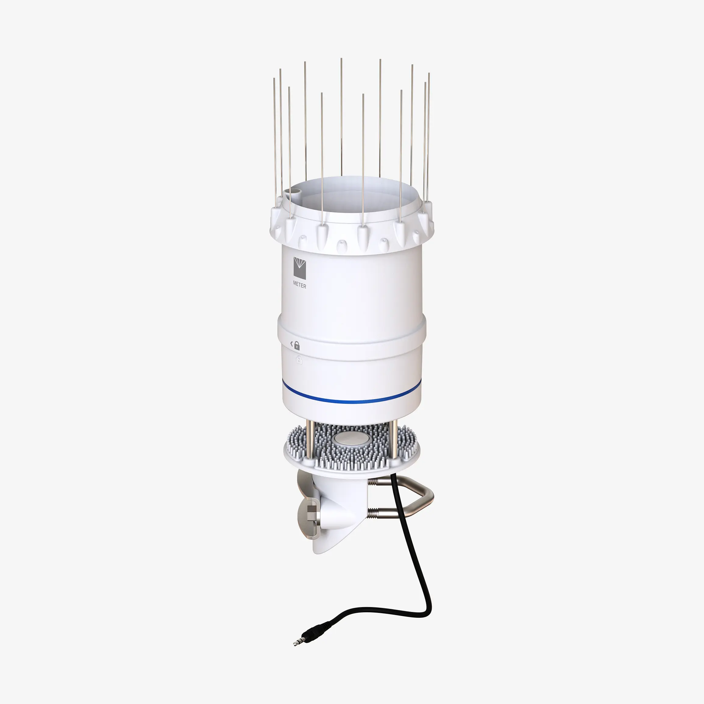
It’s important to keep birds off your remote weather station. Birds love to perch on tall things in open areas, so your weather instruments sitting out in the middle of an open area can be at risk for damage (i.e., rain gauges can get plugged up or pyranometers can get covered up as a bird defecates). Most researchers attach a bird spike ring to keep birds off.
In addition, pay attention to cable management. Electrical connections and cables are the number one source of problems with any environmental instrumentation. Those connections are critical, but they’re easy to compromise. So if cables are running along the ground, make sure to protect those cables with flexible conduit or small animals will chew on them.
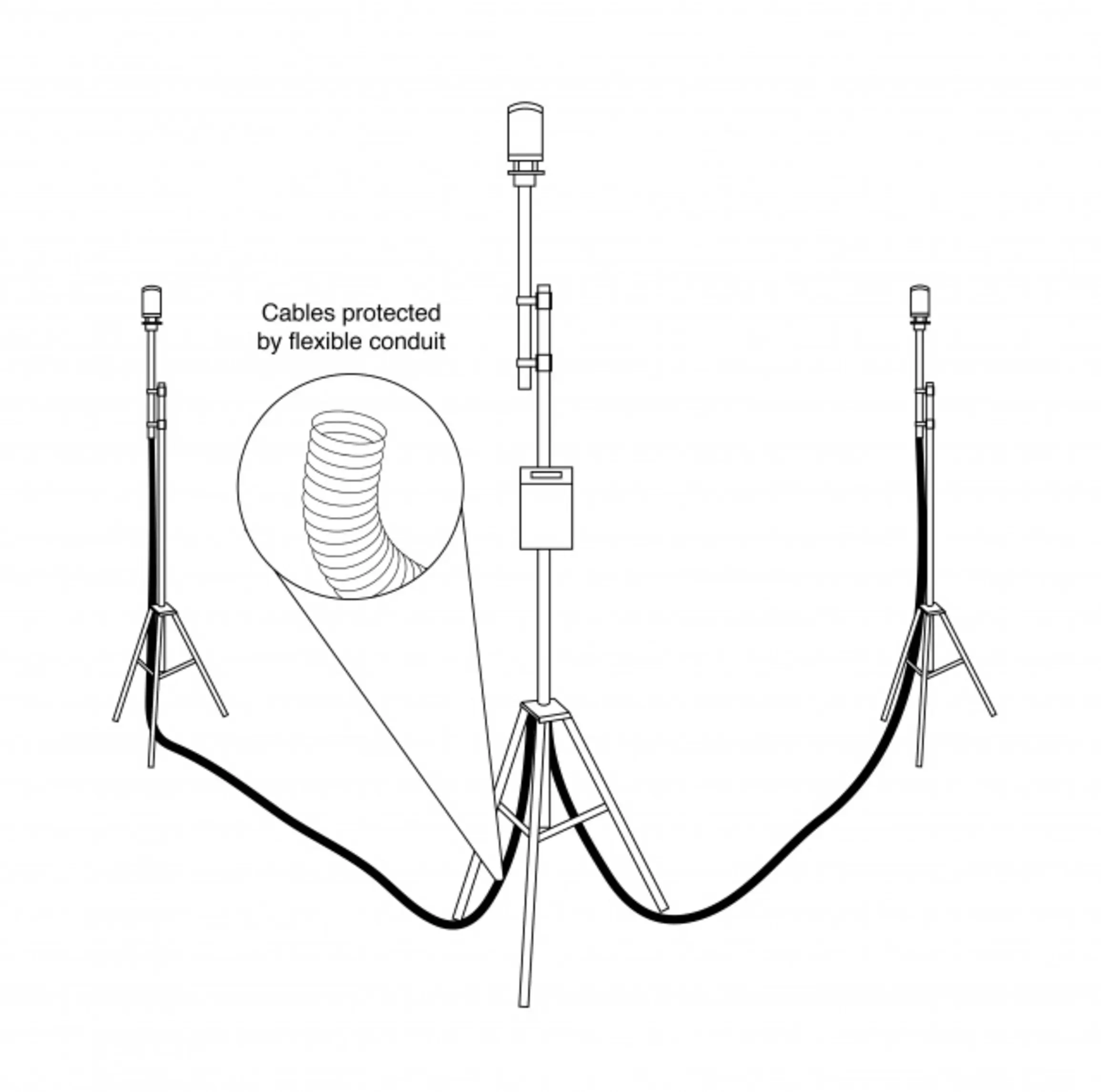
Figure 13 is an example of bad cable management for a remote weather station. You don’t want the cables hanging unsecured.
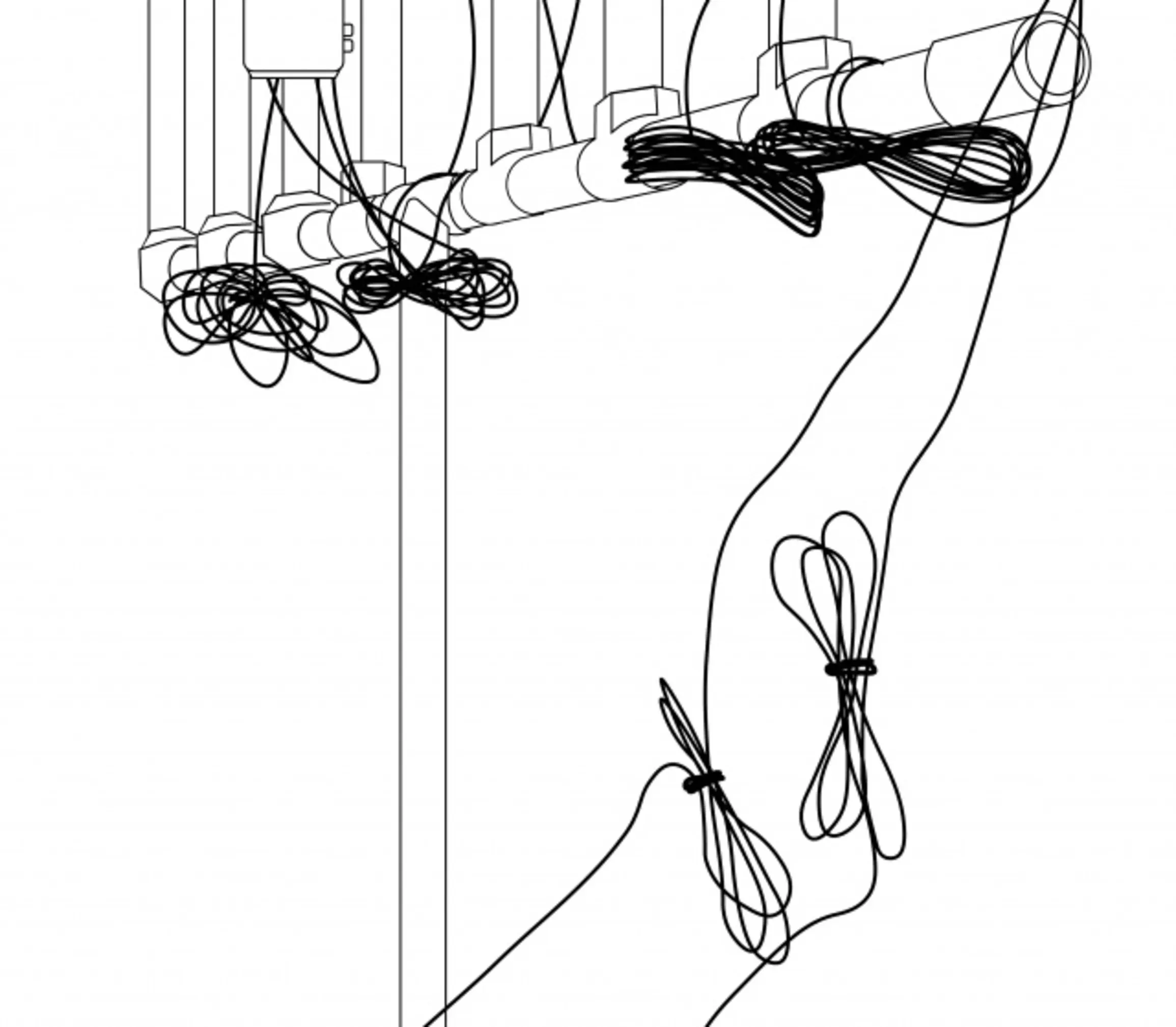
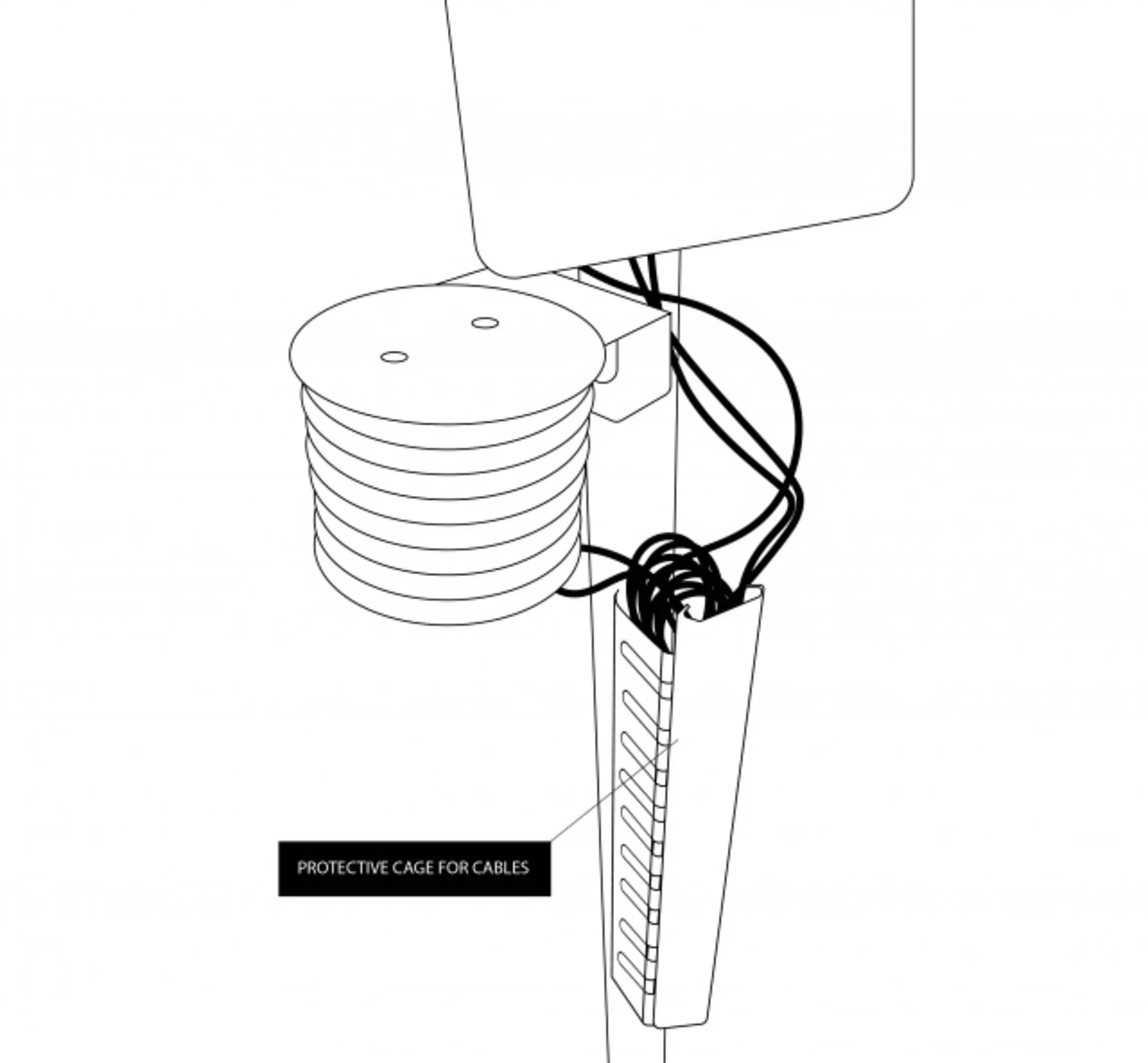
Figure 14 is an example of good cable management. This setup uses a cable management system with a cage that keeps all the cables tidy and protected. They won’t get snagged by animals, and it will be difficult for animals to access or chew on them.
Before you leave the field, remember to level your weather instruments. If you don’t, the rain gauge will have obvious errors because its catch or opening is altered. The anemometer, pyranometer or long wave radiation sensor will also be subject to errors if you don’t ensure they’re level. Figure 15 shows what can happen to the data from unleveled radiation sensors.
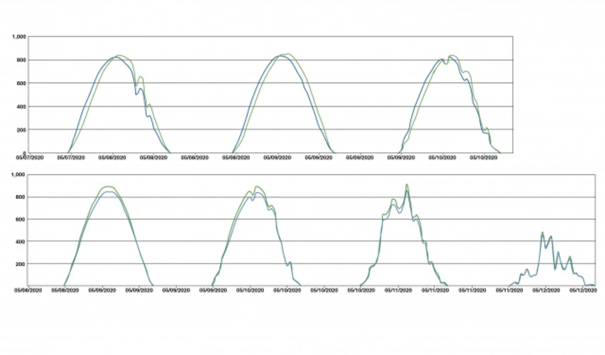
The upper graph in Figure 15 shows data from two pyranometers. One of the sensors is pointed off to the east and one of them is level. The one pointing east comes online earlier and peaks out earlier, so there is an offset from having one sensor off level.
The lower graph in Figure 15 shows that on clear sky days there’s an offset that looks like error in the calibration of one of the solar radiation sensors. However, the last day is a cloudy day where both sensors agree almost perfectly. So the error is actually one sensor pointed slightly to the south and picking up more radiation than than the level sensor. You don’t see the error on the diffuse sky days, but you can see it on the clear sky days. These types of errors are difficult to identify from a single sensor at a site, so it’s important to level those weather instruments. Nearly all remote weather stations include a bubble level to level the sensors. The ATMOS 41 weather station has an accelerometer that provides X and Y tilt in your data stream so you can check if things are level remotely without having to visit the sensors in the field.
Also before you leave the site, check the data for each measurement and make sure they’re plausible. If the temperature data says it’s cold on a day that feels warm, there is obviously a problem. Check the radiation sensor to ensure it’s reading something reasonable. We’ve seen people leave the cap on their pyranometer and not notice it until much later. If they had checked the data, they would have seen it was reading something close to zero watts per meter squared instead of up to 1000 watts per meter squared.
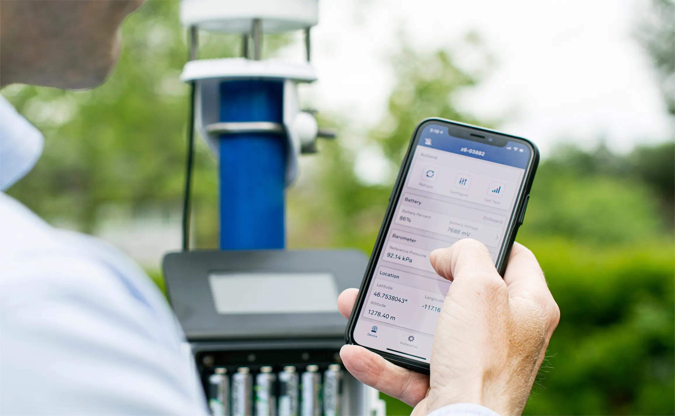
ZENTRA utility mobile enables you to use bluetooth to check your values on a smartphone or tablet. If you have cellular data at your site, you can also use ZENTRA Cloud field app on a smartphone or a tablet to make sure that the data are streaming to the cloud.
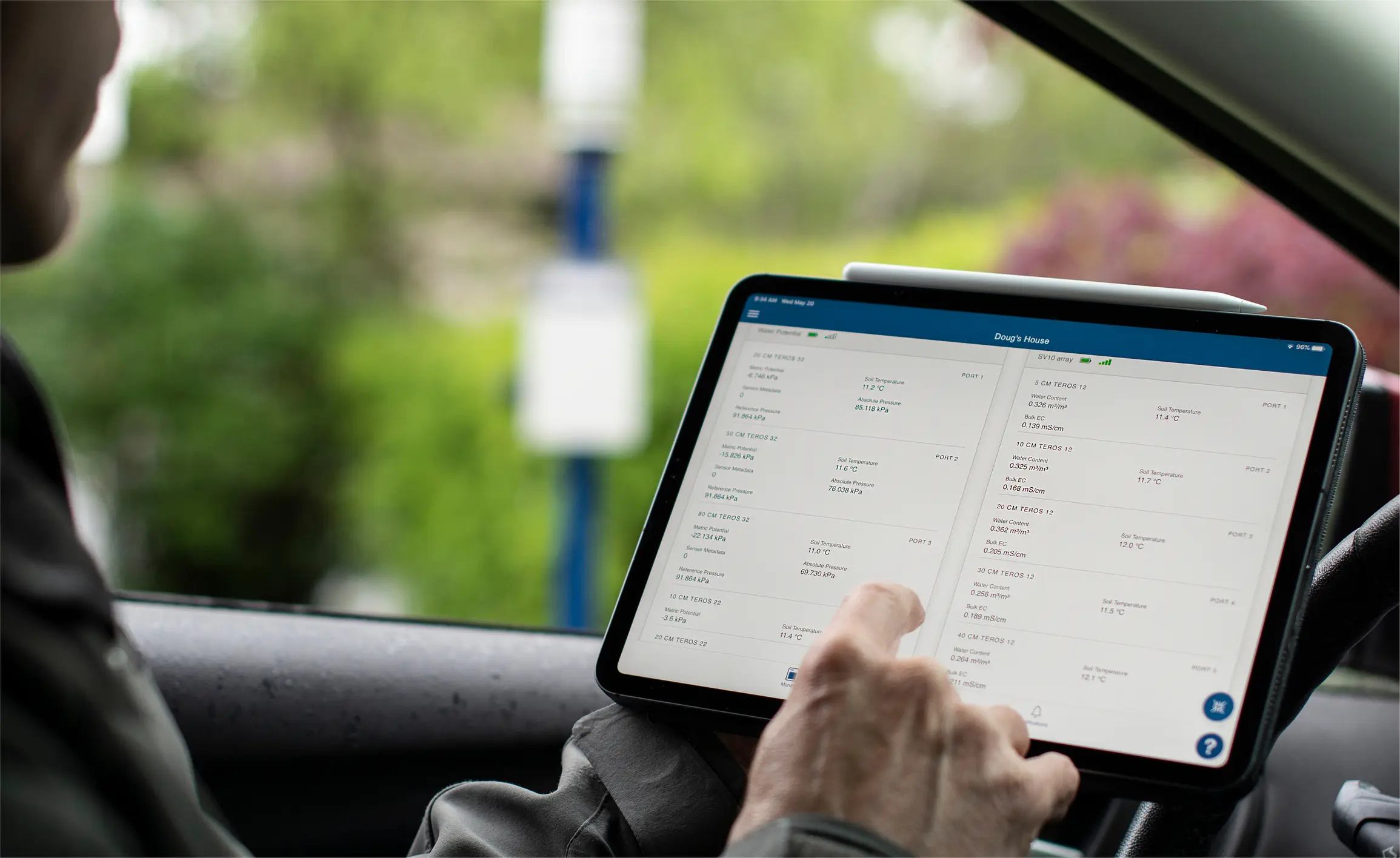
Also, use these tools to confirm the system power supply is charging and working well before you leave. Then you can have complete confidence that you’ll have the data you need when you get back to the office.
Prepare for possible problems with your remote weather station setup by ensuring you can access support documentation for the different weather instruments you are using. Bring user manuals (an electronic copy or hardcopy), integrators guides, technical sheets, or anything you might need for troubleshooting. And don’t forget to bring the contact information for the instrumentation support departments. They can be helpful if you run into problems.
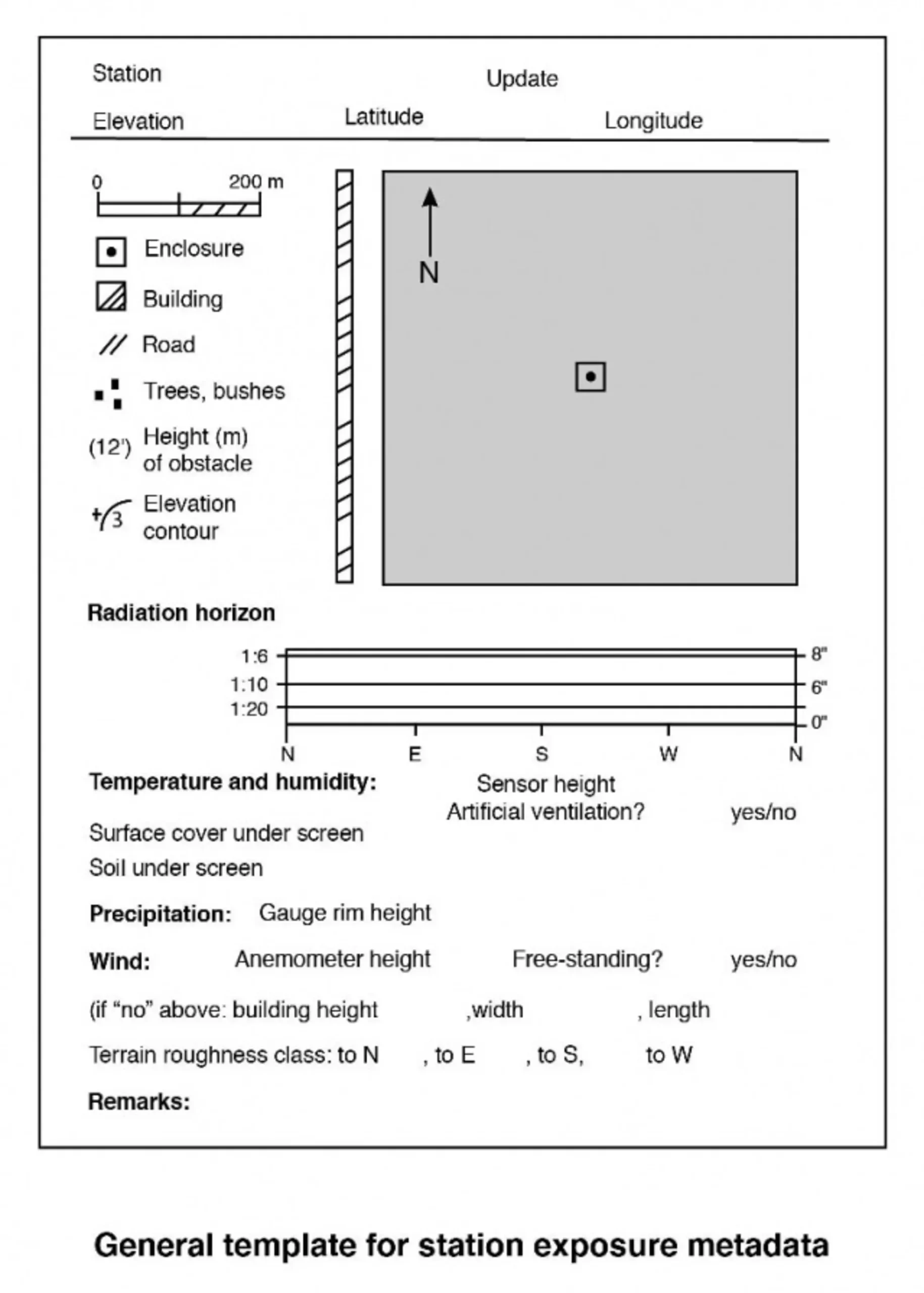
One thing researchers often overlook is writing down the relevant metadata that make their data more meaningful. Remember the famous quote: “The shortest pencil is longer than the longest memory.” If you don’t write it down, you’ll forget crucial information you need to understand your data. Important metadata to record are your GPS location, site elevation, heights of your weather instruments and the depths if you’re measuring in the soil or water. You’ll also need to record the slope and aspect of your site, vegetation characteristics, any obstructions, shading issues, and any exposure to buildings, pavements, or water bodies.
The WMO standard provides a template that might be helpful to take to the field and jot down some notes. But also be sure to take photographs. Photos of your instrumentation setup will be invaluable later on, especially panoramic photos of the site.
If you visit Washington State University’s AG WeatherNet web portal, you’ll see panoramic photos of every one of their hundreds of stations. In a few of the pictures you can see it’s not a perfect site for a weather station. There are some trees violating some of the WMO standards, but if you know that, it gives your measurements more meaning.
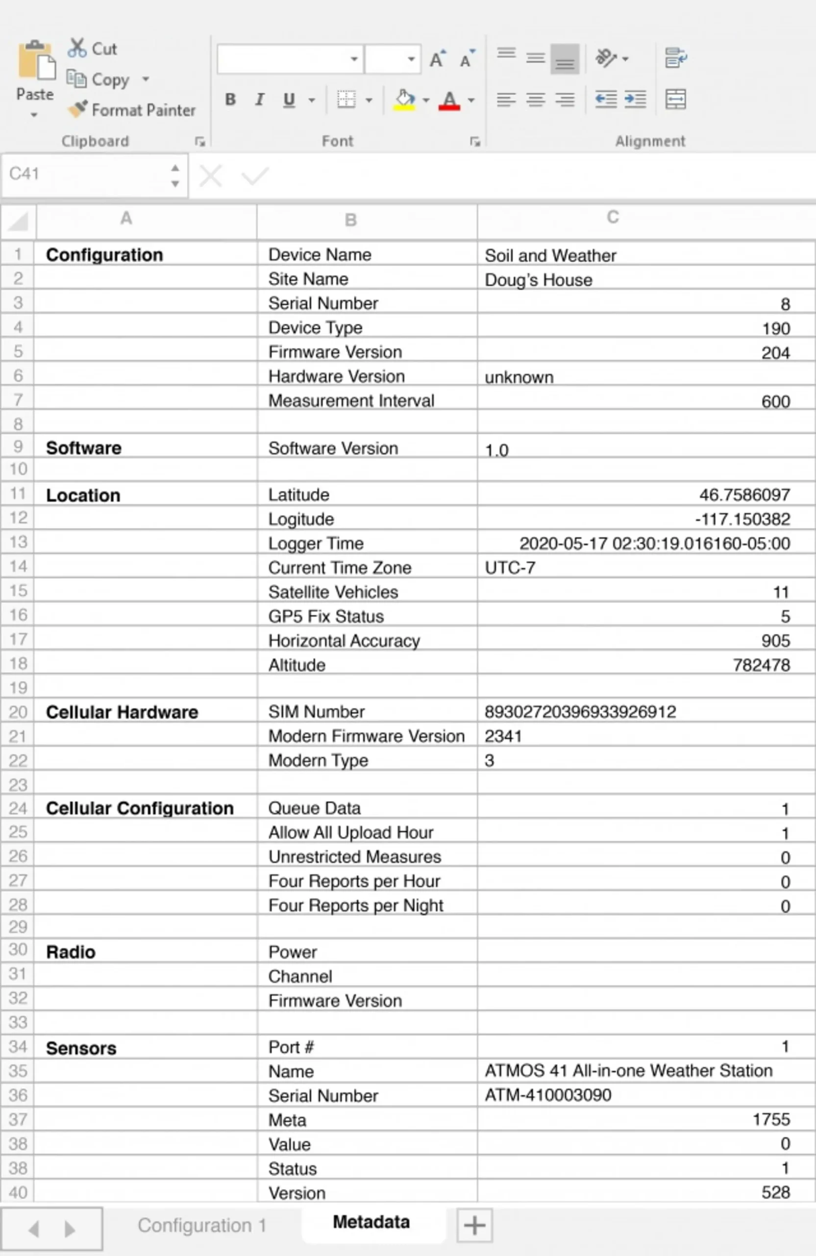
Make sure you also collect the metadata for your instrumentation. Figure 19 is an Excel file downloaded from ZENTRA cloud. When you download your data from ZENTRA Cloud, you get all the relevant metadata: information about your logger: the SIM card, and the cell signal, the GPS location, plus you get the sensor serial numbers and the names of all your instrumentation. You can also add extra fields that give even more meaning to those metadata, such as firmware versions etc. METER is continuously improving the metadata function of ZENTRA cloud, so look for more capabilities in the future.
Lastly, when you get back to the office, check the data early and often. Remote data access for remote weather stations is a huge help. With ZENTRA Cloud and other remote data access programs, your data are already graphed out so you can look for data anomalies or problems with your site. There are alerts in ZENTRA Cloud that will tell you if there’s a problem.
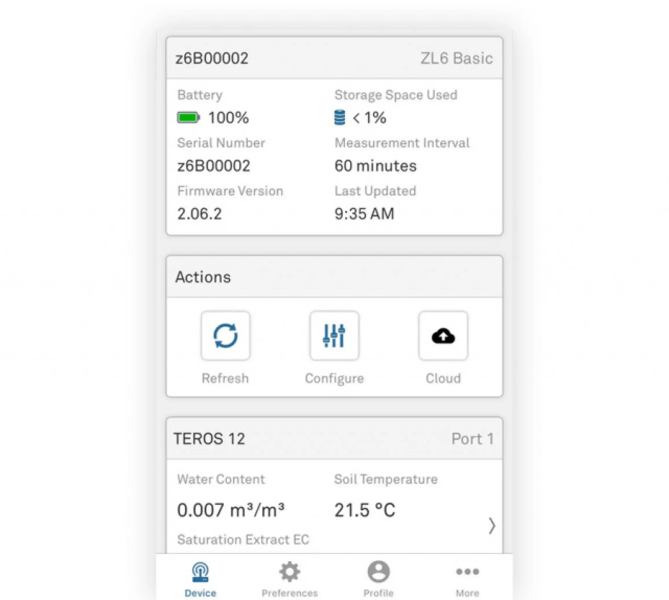
For example you can check the battery charge level to see when to go to the field to replace batteries. If you look at your data on a routine basis, it will help you achieve a high quality data set.
When leveling and orienting your weather instruments, what level of precision should you be looking for?
The more level the better. Dead on 00 for x and y is best or you’ll end up with errors in radiation. If you look up Lambert’s cosine law it will tell you the errors you could expect on clear sky days from the solar radiation measurement. Rain gauges are especially problematic, especially with a tipping bucket or a drop counting rain gauge. If it’s off level enough, it won’t collect the rainfall measurement. We recommend you keep your station level within two degrees in both x and y for best possible measurements because if you get four or five degrees off level, that’s going to be problematic for your data.
What are best practices for measuring weather variables in urban areas? Any recommendations for that kind of installation?
The micro-environments in urban areas are more severe than in natural areas. So put your weather station at the location you are interested in, not two blocks away or on the other side of the building where there is sun instead of shade. You have to take into account the microclimate effects. Many urban areas will put out dense networks of weather instrumentation to try and characterize microclimate effects and get more localized observations for their stakeholders.
Do you have a specific checklist to follow when it comes to remote weather station installation?
We highly recommend using a checklist. We have a general installation checklist here and weather station installation considerations here.
Do you have any recommendations for calibration or maintenance of your weather instruments?
Most instruments will have some degree of drift in the measurement and lose accuracy over time. Routine recalibration of weather instruments is standard practice. Each manufacturer of radiation sensors, humidity sensors, temperature sensors, or barometric pressure sensors will specify a drift and give recommendations on how often to recalibrate the sensors. We recommend replacing the ATMOS 41 solar radiation sensor every two years. And we have the same recommendation for the barometric pressure and relative humidity daughterboard. We feel strongly about keeping the sensors accurate, so those components are field swappable, and we’ve tried to make that easy for the user.
If you’re dealing with remote weather station installation in a place that might not be very stable like a glacier surface, what do you suggest for a situation like that?
In a glacier, you should drive a post very deep into that glacier to make sure there’s enough stability to hold your weather station in place. It’s a tough situation because the heights above the surface are going to change over time. And the presence of the weather station might induce some microclimate effects like melting. It would be a good idea if you had remote data access and photos in your stream to see what’s happening in near real time so you can fix the installation if you have problems.
Discover the ATMOS 41 weather station and the ZL6 data logger.
Want to learn how weather stations can be used in your application? Our scientists have decades of experience helping researchers and growers measure the soil-plant-atmosphere continuum.
Our application experts demonstrate how to correctly clean the ATMOS 41 all-in-one weather station.
In this video, our application experts show how to replace an ATMOS 41 daughter board—RH/temperature/barometric pressure sensor.
Learn how to install the ZL6 data logger.
